The Via Silente infopoint is located in Velina, km 9 from point 0, in front of Bar Giordano. At the venue the Wayfarer can register on the route by picking up the Silentine and map. Before leaving, he can ask for information and gather useful materials for the trip: what to see, where to eat, etc.
At the Via Silente infopoint, the wayfarer will also get answers about the major trekking routes in the Cilento National Park and routes that can be done on horseback.
The morphology of the territory of the Cilento and Vallo di Diano National Park is rather complex, consequently so is the Route, which includes continuous changes of slope with a maximum elevation (optional stage) of 1800 meters, on Mount Cervati. Therefore, a fair amount of training is required, but above all the desire to want to traverse the Cilento slowly. The best means to enjoy the Way not having much time is obviously the e-bike
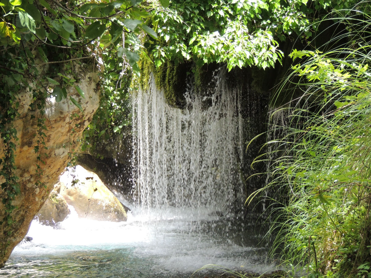
From a climatic point of view, Cilento is a happy island: in winter temperatures hardly go below zero and the presence of the sea mitigates the summer sultriness. The Via can therefore be traveled at any time of the year, excluding the peaks if they are snow-covered, but taking into account the availability of services along the way. Therefore, it is necessary to plan the trip carefully, inquiring about the opening of accommodation facilities and ascertaining the heating services of those facilities.. We therefore advise you to contact the contact persons in advance (PDF under facilities on the site) to find this information.
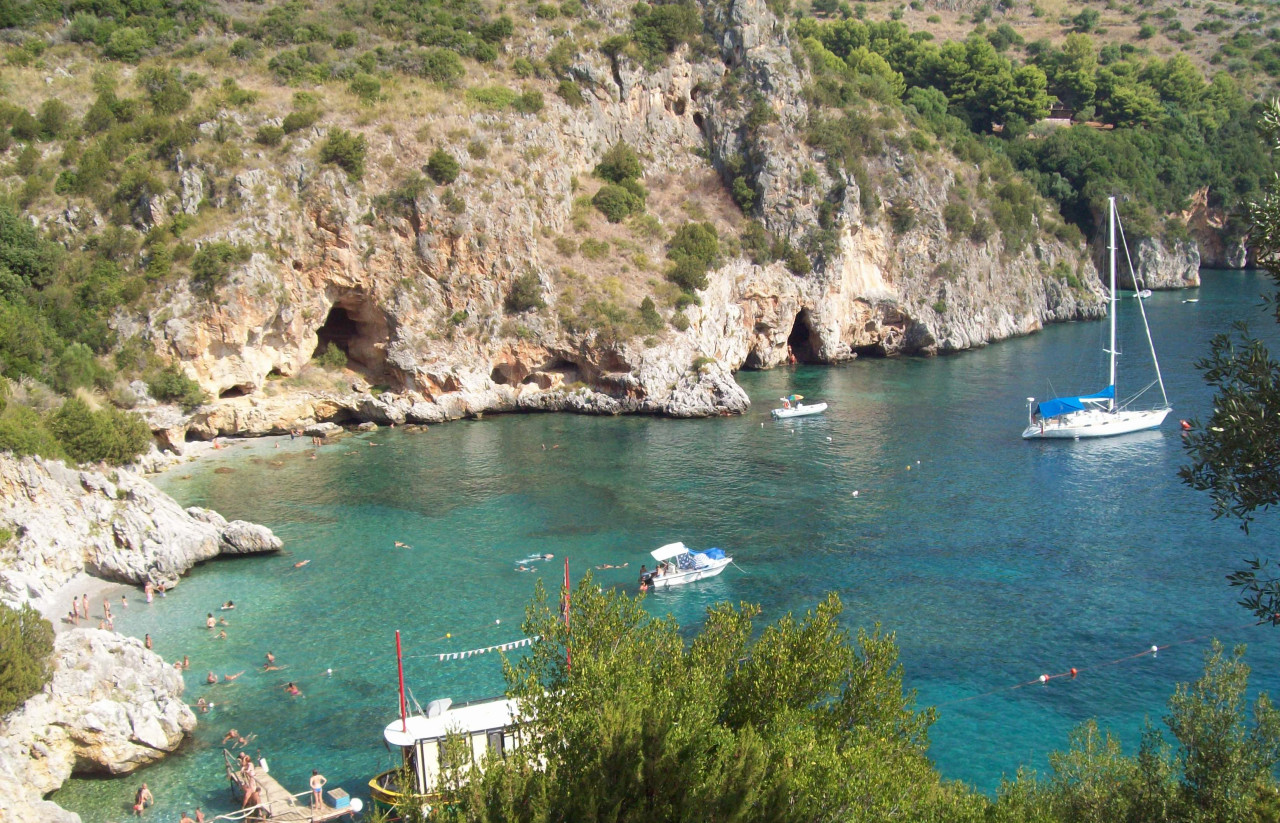
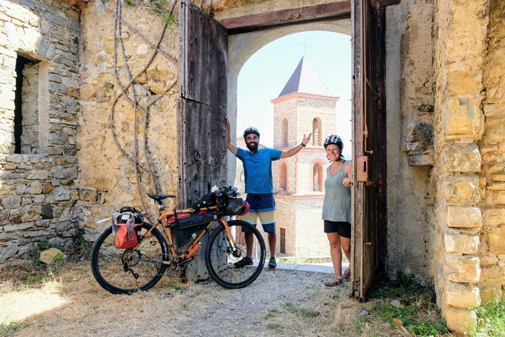
The Silent Way embraces or reaches four of the most representative peaks in the territory of the Cilento, Vallo di Diano and Alburni National Park: Mount Stella, which is only “circumped” without reaching its summit; the Alburni Mountains, in the pass between Petina and Sant’angelo a Fasanella (1200m); Mount Cervati, the highest in the Campania region, whose summit is reached by a round trip from Sanza in the 9thTappa ( 1800m) and finally Mount Sacro or Gelbison (1680m) the last effort of the Via Silente, also a round trip (unless you decide to stay overnight with free camping) lower than Cervati but, according to many, harder to climb. Except for the ascent to Cervati, which for 12 of km is on dirt road, all other peaks can be reached on asphalt.
Ninety percent of the Silent Way is on asphalt, and the dirt sections are bypassable. However, it is good to keep in mind that the state of the road surface is not always well maintained. The Cilento area is notoriously landslide-prone which often leads to road deformation. Therefore, it is recommended to use a mtb or trekking bike. Particular attention is recommended for those who decide to set off on a road bike instead.
Apart from short stretches on the coast, you will encounter very few motor vehicles on the Silent Way
This is one of the most frequently asked questions . The Silent Way is 90 percent on asphalt, making it unattractive for trekking enthusiasts. However, the roads traveled have a very low level of traffic, and more importantly, the villages crossed and the water sources, are very numerous. Thus, with good trip planning that especially takes into account the distance between accommodations along the route, it is possible to walk as well as ride on the Silent Way. We also add that the Via Silente Association is in contact with all hiking associations in the area, including trekking and horseback riding. We will be happy to put you in touch with the associations that care for the walks. Among these the most important are, the Two Primroses Walk ( https://www.ledueprimule.it/ ) and the St. Nilus Walk(https://www.camminibizantini.com/cammino-di-san-nilo/)
The railway stations are all located along the coast, starting from Agropoli to Sapri. Bicycles can be carried on most of the trains that cross this route.
Internal transportation, on the other hand, is scarce and often limited to a morning bus ride to Vallo della Lucania and, with change, Castelnuovo C. and Vallo – Castelnuovo C. train station.
Yes, just choose the starting and ending points appropriately among the stages taking into account the presence of contracted facilities. On the paper map and under gpx tracks on the website, there are also cuts to shorten the Way for those who do not have enough time
It is the document that attests to the status of the Wayfarer. It can be picked up at the km 0 infopoint in Velina, along with the materials needed to tackle the journey: map and roadbook. Presenting the Silentina at participating facilities entitles you to a 20 percent discount on overnight stays.
There is no organized service, but some private reception facilities are available to transport luggage. It is therefore necessary to contact the facilities at which you will be staying individually to check the availability of the service.
Luggage transportation is provided by some tour operators who include the service in the tour package
Signage is good ( although currently being tested and supplemented) It is advisable, however, to have a map (with elevation profiles on the back) and roadbook in which the route is precise and detailed.
It is possible to download the tracks of the entire route from the site under Route – GPS Tracks
You can also find the tracks by clicking on the link in our Komoot account : https://www.komoot.com/user/952173553371
The best bike is a hybrid or a lightweight MTB without shock absorbers. Those who still want to use a road bike can do so by bypassing the dirt sections but paying close attention to the potholes in the asphalt and the small differences in elevation caused by micro-cracks.
All facilities are listed and updated on the
Facilities section of the site
On the page of the website dedicated to hosting you can download the complete list of hosting facilities, along with links to information on their respective prices. Presenting the Silentina will entitle you to a discount on overnight stays
If you choose to make your own travel arrangements, we suggest that you make reservations at tourist facilities, at least one day in advance in the low season and well in advance in the high season (July-August), otherwise you may be left without accommodation. To contact facilities, see the full list on the hospitality page
With the exception of the coast where it is possible to stay in hotels and lodges, the rest of the facilities on the Silent Way are agritourism and B&Bs. There are two accommodations in Castelnuovo Cilento, Casa Silente and La Casa dei Ciottoli. All other facilities in the departure area are located in Velina
There are numerous campgrounds along the thing, less so in the interior where one can choose to free camp in compliance with all environmentally friendly rules. It is forbidden to light fires in the Cilento National Park area.
More and more facilities offer a menu proposal specifically for wayfarers, at attractive prices (around 12-15 euros is a meal with first course, second course and drinks). It is good to inquire upon arrival directly with the operators of your host facilities.
The refreshment points are all located in the towns along the route but on some stages at a maximum of 5 km from these
Tourist facilities will accommodate you on average for 25-30 Euro per day in a double room in the mid-season periods
Dinner can cost 15-20 euros, a light lunch around 10 euros, an Italian breakfast around 3 euros.

| Cookie | Duration | Description |
|---|---|---|
| _icl_current_language | This cookie is stored by the WordPress WPML plugin. The purpose of the cookie is to store the current language. |
| Cookie | Duration | Description |
|---|---|---|
| cookielawinfo-checkbox-analytics | This cookie is set by GDPR Cookie Consent plugin. The cookie is used to store the user consent for the cookies in the category "Analytics". | |
| cookielawinfo-checkbox-functional | The cookie is set by GDPR cookie consent to record the user consent for the cookies in the category "Functional". | |
| cookielawinfo-checkbox-necessary | This cookie is set by GDPR Cookie Consent plugin. The cookies is used to store the user consent for the cookies in the "Necessary" category. | |
| cookielawinfo-checkbox-others | This cookie is set by GDPR Cookie Consent plugin. The cookie is used to store the user consent for the cookies in the category "Other. | |
| cookielawinfo-checkbox-performance | This cookie is set by GDPR Cookie Consent plugin. The cookie is used to store the user consent for the cookies in the "Performance" category. | |
| viewed_cookie_policy | The cookie is set by the GDPR Cookie Consent plugin and is used to store whether or not user has consented to the use of cookies. It does not store any personal data. |
| Cookie | Duration | Description |
|---|---|---|
| wp-wpml_current_language | No description available. |